G E O L A Y E R S Z O O M-I N A N D F L Y-B Y
This is a very simple project comprising of a zoom in and fly over some areas over the city of New York and a few labels.
In the above clip you can see the whole animation.
I've divided it into three components - Zoom In, Fly-by and Labels. I'd like to detail all these components so you can understand my thought process while making it.
The font used is called - Lemon Milk
I've divided it into three components - Zoom In, Fly-by and Labels. I'd like to detail all these components so you can understand my thought process while making it.
The font used is called - Lemon Milk
The basemap is custom, created in Mapbox.
1. Zoom In
While using geolayers the movement of the map is controlled by 5 values in the composition created by the plugin itself.
These 5 values are longitude, latitude, zoom, bearing and pitch.
To create a basic zoom in animation you can adjust the zoom value between 1 and 22 or 23 depending on what max zoom value has been allowed in the mapcomp.
To make the animation smoother we have to make keyframes over other properties as well, so it has a more dynamic feel instead of a mechanical zoom feel.
These 5 values are longitude, latitude, zoom, bearing and pitch.
To create a basic zoom in animation you can adjust the zoom value between 1 and 22 or 23 depending on what max zoom value has been allowed in the mapcomp.
To make the animation smoother we have to make keyframes over other properties as well, so it has a more dynamic feel instead of a mechanical zoom feel.
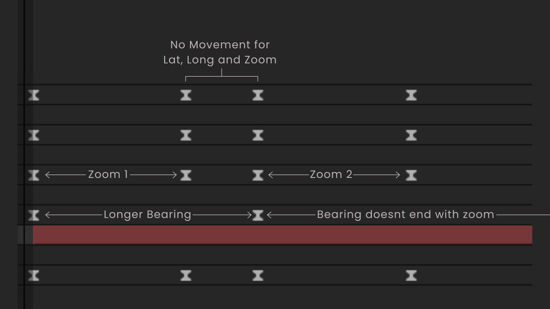
The zoom in has two parts, where the initial zoom is of a certain length and the bearing animation is a little longer. So, when the zoom in stops the bearing or the angle change goes on giving the zoom animation a smooth end.